Typhoon No. 30 remained very strong south of Okinawa on October 22
Records JMA information issued at 23:45 JST on October 22, as displayed by Mie Prefecture. It does not establish the later track, intensity or whether landfall occurred.
 Illustration
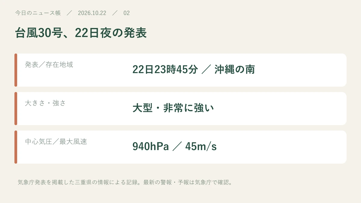
On the evening of October 22, Typhoon No. 30 was a large, very strong storm south of Okinawa. JMA information issued at 23:45 and carried by Mie Prefecture listed central pressure of 940 hPa and maximum sustained winds of 45 m/s, moving northwest.
Read for 8 seconds to inform recommendations.Reading history & counting settings
Records JMA information issued at 23:45 JST on October 22, as displayed by Mie Prefecture. It does not establish the later track, intensity or whether landfall occurred.
The late-evening report listed 940 hPa
Mie's disaster information page listed the storm south of Okinawa at 21.4°N, 124.7°E. In the JMA bulletin issued at 23:45 on October 22 it was classified as large and very strong, with central pressure of 940 hPa, maximum sustained winds of 45 m/s and northwestward movement at 15 km/h.
Separate this record from current travel decisions
These figures describe October 22, not the current situation or a future track forecast. Maximum sustained winds and peak gusts are different measures. For travel, check the latest typhoon information, local warnings and airline, railway and ferry notices together.
Sources & further reading
Our own summary based on the public information below.
- 三重県・防災みえ.jp:22日23時45分気象庁発表の台風情報 ↗Source publication date: 2026-10-22
- 気象庁:最新の台風情報 ↗
This is a record of information available at publication. Later reports may change the details. Check the source for current weather, safety and market information.