Typhoon 30 east of the Philippines; October 19 information highlights Okinawa risks
Record of the October 19 noon observation, issued at 12:45 JST, and that afternoon's forecast. Not a current warning.
 Illustration
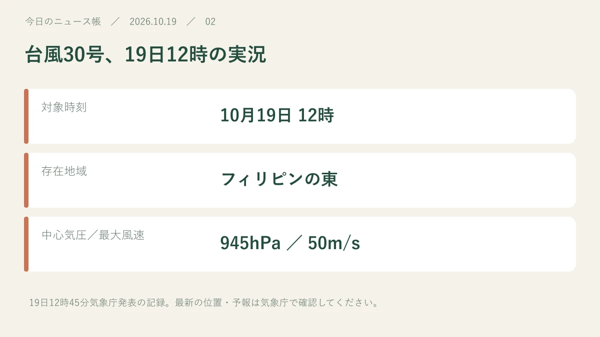
Typhoon 30 was east of the Philippines on October 19. At noon, Japan's weather agency classified it as large and very strong, with a central pressure of 945 hPa.
Read for 8 seconds to inform recommendations.Reading history & counting settings
Record of the October 19 noon observation, issued at 12:45 JST, and that afternoon's forecast. Not a current warning.
Noon observation, with its timestamp
JMA information reproduced by Mie Prefecture showed maximum sustained winds of 50 m/s and westward movement at 20 km/h. These values describe noon on October 19; they must not be treated as current conditions when reading later.
Forecasts for Okinawa and rain elsewhere
FNN's 16:08 report described possible approaches to Ishigaki and nearby islands around October 23–24, with violent winds and very rough seas. The track and timing remained forecasts. A front and low-pressure system were also expected to bring thunderstorms from Kyushu to Kanto through October 20. Check current JMA and local warnings.
Sources & further reading
Our own summary based on the public information below.
- 防災みえ.jp:19日12時45分気象庁発表・台風30号 ↗
- FNN:台風30号と前線による雨の見通し(19日16時8分) ↗Source publication date: 2026-10-19
- 気象庁:最新の台風情報 ↗
This is a record of information available at publication. Later reports may change the details. Check the source for current weather, safety and market information.